Mapping and Imagery Collectionadmin2019-10-01T22:27:22+00:00
Project Description
From the Mason-Dixon line to the snow-covered Cascades, WeDriveU’s Data Collection Services team has covered hundreds of thousands of miles for our software and telecommunications clients. Here’s how we’re helping one client gather precise, high-quality data and imagery to advance innovations in consumer tech, automotive and other segments.
- Strategic partner for year-round data and image collection since 2016
- WeDriveU has covered all continental states and gathered roughly 600,000 kilometers of unique imagery for client
- Ongoing expansion has doubled WeDriveU’s team and fleet since inception
Challenge
This leader in mapping and location platform services engaged WeDriveU in Spring 2016. Seeking a more scalable and efficient way to gather a massive volume of real-time data and images for navigation, traffic and dispatching applications, the client outsourced its data and image collection to WeDriveU.
Solution
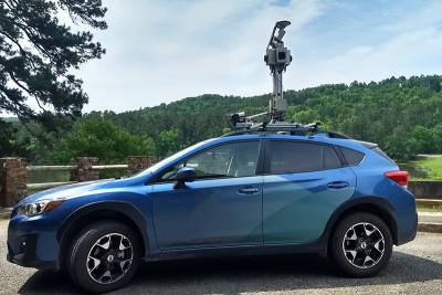
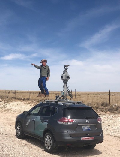 Our initial 12-week project specified a complex set of data collection routes across the U.S. and required professional drivers – referred to as “pilots” by the client – skilled at operating camera-mounted SUV-style “rigs” with cameras, Light Detection and Ranging (LiDAR) and a Global Positioning System (GPS).
To support the client’s ambitious timeline, WeDriveU mobilized drivers with experience from similar projects for our global software, hardware and telecommunications clients. WeDriveU custom-designed this client’s transportation program:
- Managing data collection plans and assignments for national driver team
- Orchestrating drivers on independent six-week assignments
- Driver training including customized instruction on the client’s fleet and equipment
- Ongoing client engagement to review metrics and align with the client’s changing business needs
Today, 15 full-time drivers conduct daytime imagery collection by operating the onboard equipment. Operations include the computer system, data unit and camera mast, and tablet computer powering collection routes in a mapping interface and displaying real-time camera displays. WeDriveU maintains the cameras and clears debris.
Results
Plans include supporting multiple departments for this client. By helping them get ahead of the sheer volume of data and image collection, it frees their internal resources to harness insights from the field and better serve customers and partners. WeDriveU is proud to help clients generate insights for these and other exciting innovation areas, such as HD mapping for things like autonomous vehicles and smart city initiatives.
Bring a Program Like this to Your Organization
Learn more about WeDriveU’s data collection capabilities and reach out to brainstorm with our team.